Log entry ·
First Activator Kopparen (LA/ST-217)
After 9km of walking and more than 16,000 steps, I got the "First Activation" badge and activated a summit that no one has activated before. The target summit was Kopparen (LA/ST-217). To me, finding unactivated summits and activating them for the first time is very exciting and something I absolutely want to keep doing!
Again I spent a lot of time on the SOTLAS Map and been eyeing the summits that have zero activations. It happened that my family’s cabin is in an area that has quite a few of those, and I decided to get one of those this weekend while we were there. So off I went to Kopparen (LA/ST-217).
The weather was so-so with a temperature of 8°C and clouds, but that is also perfect hiking weather for me. I packed my backpack, and if I was to estimate the weight, it was about 10kg. At some point in time I will make a post detailing what I bring along on these longer activations, but for now a short list will have to do:
- My Xiegu G90 with an 8000mAh LiPo battery
- PAC-12 7MHz-50MHz antenna with a 5.6m whip antenna
- KL 203 P portable PA that is modified to work on 20m and a 12V motorbike starter battery
- Rite in the Rain top spiral notebook and a Rite in the Rain Work Ready Mechanical Pencil
- Various cables, tools, and other things to make the trip more comfortable
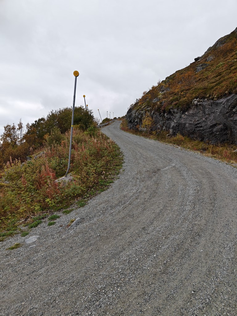
The hike up to the summit follows a 4.5km gravel road all the way up. There is an alternative route on the other side of the summit that is shorter but a lot steeper and is a path and not a road. No vehicles are allowed on the gravel road, and it is quite steep after the first kilometer. The first leg of the road goes through a forested area with a few cabins along the road. After a bit, the incline started and the forest started to diminish.
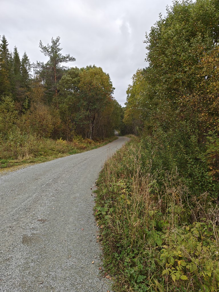
First leg into a forested area.
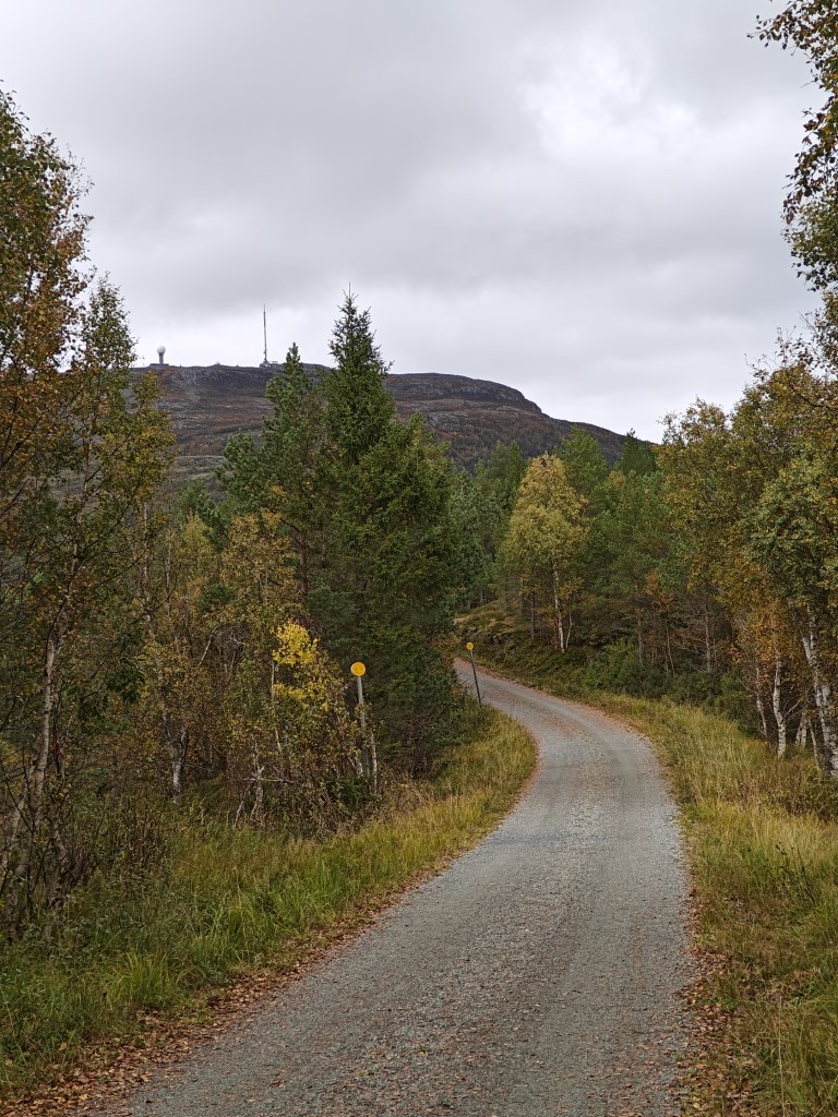
Road starts to climb and I see the destination.
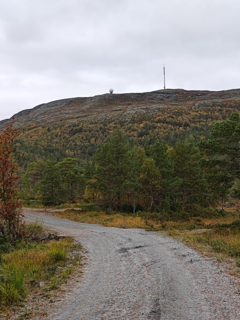
Getting closer.
It was then I remembered I forgot to bring anything but a 0.5L soda bottle, but luckily about halfway up there was a small stream where I could refill it. I prefer to bring a lot more than 0.5L of drink when hiking, but turning around was not an option for me.
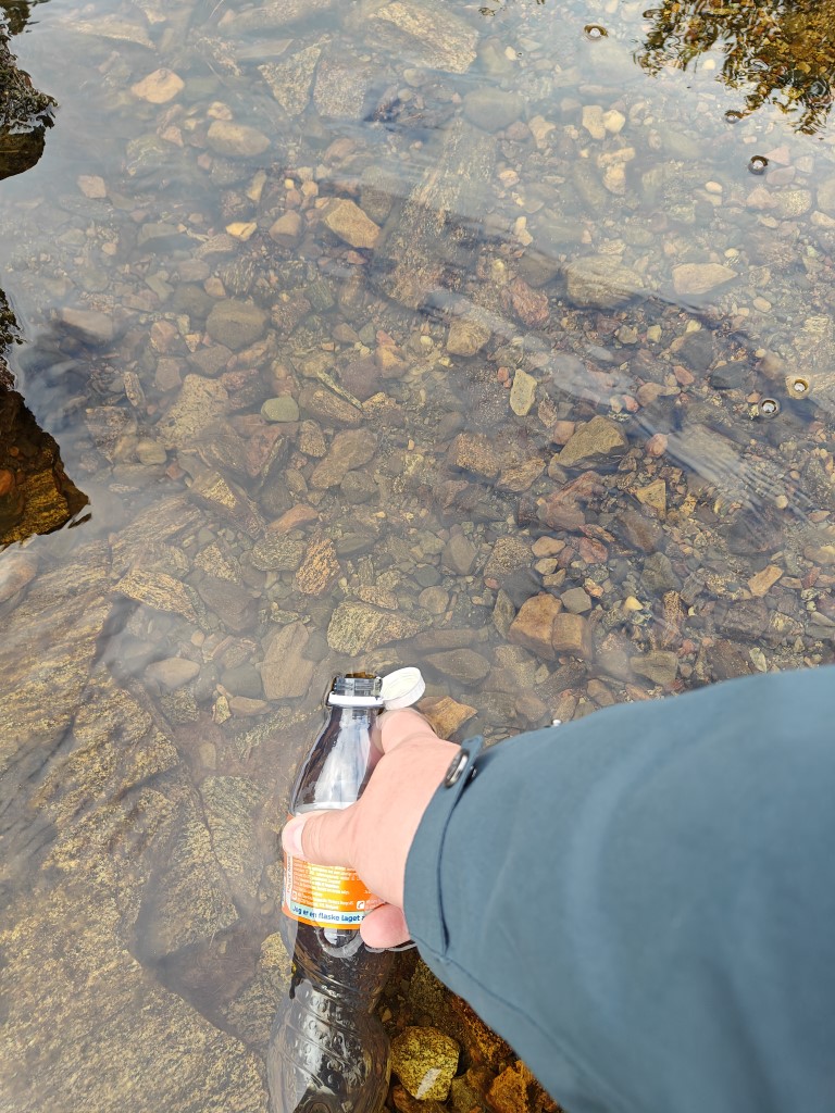
Filling my soda bottle with water from a stream.
After a halfway break where I filled up the reserves with an energy bar, the road became even more steep and my heart rate spiked at 150 at times. Great cardio exercise for sure. There were a few other people going up and down, but not everyone was as red-faced as me…
This does not look very steep in the picture, but I assure you that it was.
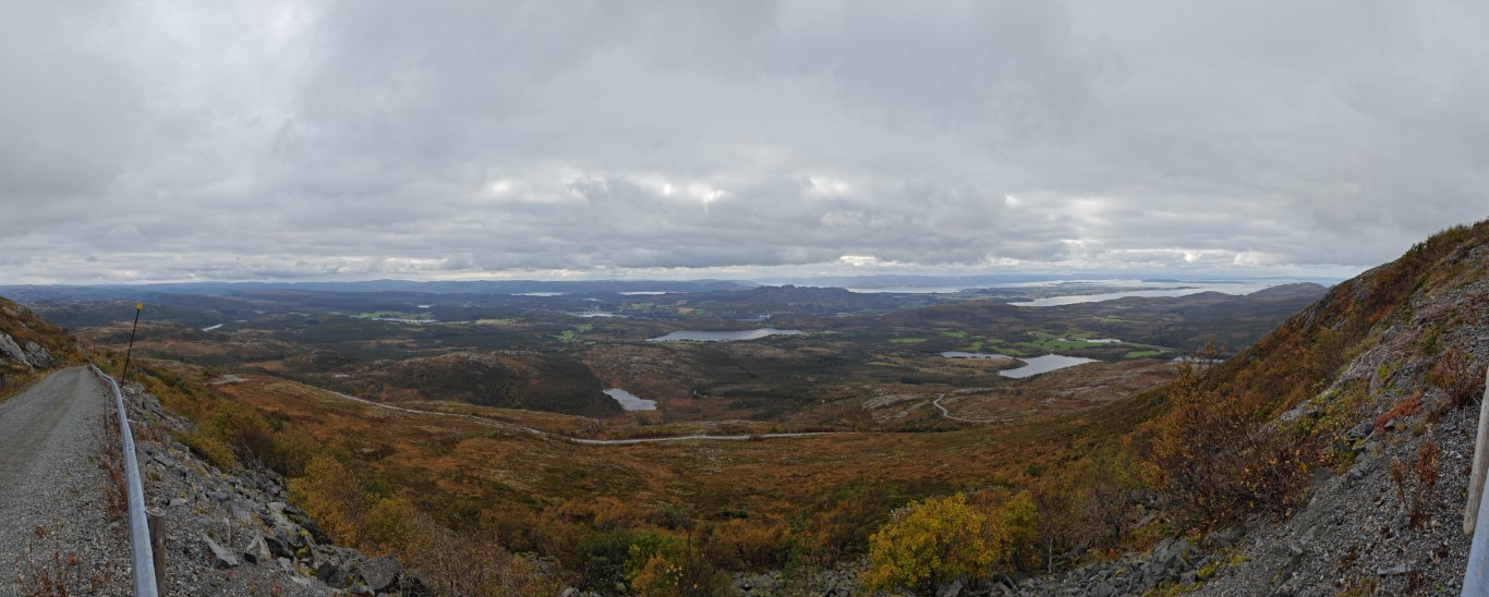
Panorama view close to the top of the summit.
On the top of the summit there is a huge radio tower operated by one of the national telecom companies and a not-so-secret military radar installation. I set up my vertical antenna and its counterpoise wires and got it adjusted to 20m. I love that it gets an SWR of 1.0 without using the G90 tuner—which in turn means I can use my little PA without any SWR issues. I did a test call with a person from the Netherlands (unfortunately I forgot to note the callsign). Then I tried to reach some fellow Norwegians that I was chatting with on Discord, but it seems we were inside the skip distance so no contact was possible there.
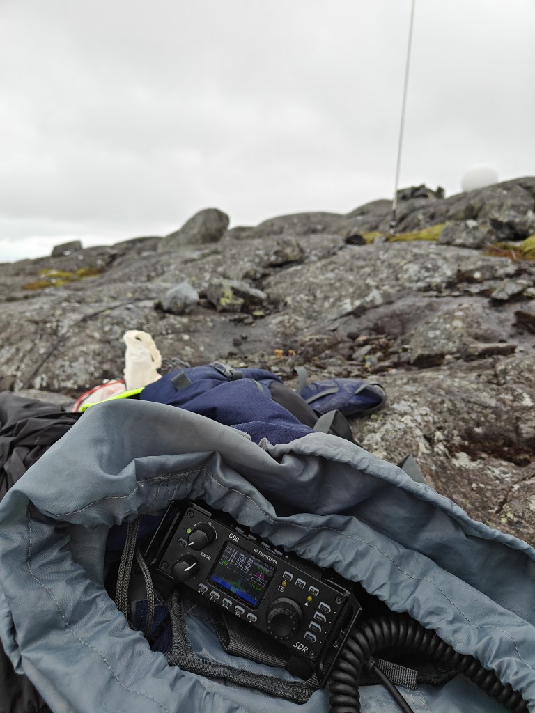
Radio up and running with the antenna in the background. It started to drizzle.
I self-spotted on SOTA Watch and seconds later I had a pileup to manage. However, this round I did not have the luxury of getting help from Stian LB5SH and his 9 years of experience running multiple DXpeditions and thousands of QSOs. So that meant it was all up to me!
I must admit it is both exciting and frightening to have 5-10 people call you at the same time. The exciting bit is that everything is working and I am able to reach out to people and get the activation in the logbook. The scary part is that I want people to have a good impression of me and have a good experience chasing my activations so they will come back later. Luckily I feel that most HAMs out there are very patient and understand that someone is new to the hobby and needs a bit more time to get things sorted and noted. Usually it takes me a couple of tries to get their callsign correct, especially if their callsign does not follow the usual 2 letters, 1 number, 2-3 letters format. I am also not very familiar with the country suffixes, and that sometimes gets me a bit confused. However, as with many other things in life, this will only improve with time.
After an hour or so the QSO intervals waned and my hands were quite cold. At some point it started to rain as well, so I had to improvise some cover for the radio and the PA. It would be great if I could come up with some kind of mini tent or shelter that I can set up that does not weigh too much. But that is on the wishlist for future activations. Anyway, I decided to pack my stuff and return from the summit. I got in a couple more QSOs while packing, and the end result was 31 QSOs in about one hour. I am very happy with that.
I also got a summit-to-summit activation, and this is something I must remember to chase when I am set up. I need to dedicate some time at the end of the activation to look at the spots and try to make some summit-to-summit QSOs.
The hike down went fairly smoothly even though my legs felt the number of steps accumulated through the 9km walk.
Thanks for reading and CQ later!